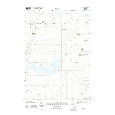
2013 Map of Hamburg
USGS Topo · Published 2013About this map
Hamburg and the smaller settlement of Assumption anchor this rural landscape along the border of Carver and Sibley Counties. The map reveals a high density of burial grounds reflecting the area's diverse early religious roots, from the Emanuel Lutheran Church Cem to the Bovy Family Cem and the Saint Paul's Evangelical Reformed Church Cem. The terrain is defined by a complex network of wetlands and drainage systems, including the Judicial Ditch Number Three A and the County Ditch Number Twentyfive A, which manage the water levels of Washington Lake and Erin Lake. This agricultural grid, intersected by state routes like MN-5 and MN-25, illustrates the ongoing balance between farming and the preservation of central Minnesota's lake-heavy topography.
Find a feature on this map
56 named features on this map. Tap any name to fly to it.
Don’t see what you’re looking for? This feature index may not catch every label — zoom into the map to look around manually.
Map Details
Editions of this 2013 Hamburg Map
This is the sole edition of this map. No revisions or reprints were ever made.
Other maps of this area

1953 · Saint Paul
USGS Topo · 1:250,000

1953 · New Ulm
USGS Topo · 1:250,000

1957 · New Ulm
USGS Topo · 1:250,000

1957 · Belle Plaine
USGS Topo · 1:62,500

1957 · Waconia
USGS Topo · 1:62,500

1958 · New Ulm
USGS Topo · 1:250,000

1958 · Gaylord
USGS Topo · 1:62,500

1958 · Glencoe
USGS Topo · 1:62,500

1959 · Saint Paul
USGS Topo · 1:250,000

1967 · New Ulm
USGS Topo · 1:250,000