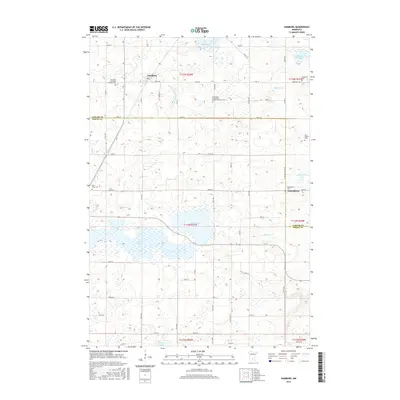
2016 Map of Hamburg
USGS Topo · Published 2016About this map
The agricultural landscape of Hamburg and the surrounding township occupies a glaciated terrain defined by numerous lakes and drainage networks along the border of Carver and Sibley Counties. This 2016 survey illustrates a region where local heritage is preserved in a high density of rural burial grounds and parish centers, including the Emanuel Lutheran Church Cem and the Saint Paul's Evangelical Reformed Church Cem. The land is heavily managed for water control, notably via the Judicial Ditch Number Three A, which connects the wetlands surrounding Frederick Lake and Washington Lake. Smaller settlements like Assumption serve as focal points for the farming community, while family-named landmarks such as the Bovy Family Cem and Snapsburg Cem provide specific points of interest for genealogists tracing the early German and European families of the Minnesota river valley hinterlands.
Find a feature on this map
66 named features on this map. Tap any name to fly to it.
Don’t see what you’re looking for? This feature index may not catch every label — zoom into the map to look around manually.
Map Details
Editions of this 2016 Hamburg Map
This is the sole edition of this map. No revisions or reprints were ever made.
Other maps of this area

1953 · Saint Paul
USGS Topo · 1:250,000

1953 · New Ulm
USGS Topo · 1:250,000

1957 · New Ulm
USGS Topo · 1:250,000

1957 · Belle Plaine
USGS Topo · 1:62,500

1957 · Waconia
USGS Topo · 1:62,500

1958 · New Ulm
USGS Topo · 1:250,000

1958 · Gaylord
USGS Topo · 1:62,500

1958 · Glencoe
USGS Topo · 1:62,500

1959 · Saint Paul
USGS Topo · 1:250,000

1967 · New Ulm
USGS Topo · 1:250,000