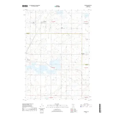
2019 Map of Hamburg
USGS Topo · Published 2019About this map
Glacial lakes and rural farmsteads dominate this pocket of the Upper Midwest, where the border of Carver and Sibley Counties bisects a landscape of rich agricultural tradition. The town of Hamburg serves as a northern anchor, characterized by its residential grid and proximity to the Emanuel Lutheran Church Cem. The area is defined by its complex hydrology, with substantial water bodies like Washington Lake, Erin Lake, and the meandering Bevens Cr providing natural breaks in the rectangular township-and-range survey grid. Local history is deeply rooted in several community centers, including Green Isle and the settlement at Assumption. Genealogists will find a wealth of specific landmarks, from established churchyards like Saint Paul's Evangelical Reformed Church Cem to smaller, private resting places such as the Bovy Family Cem. These sites, along with a network of country roads like Co Rd 50 and Cty Rd 33, reveal the enduring settlement patterns of these Minnesota prairies.
Find a feature on this map
67 named features on this map. Tap any name to fly to it.
Don’t see what you’re looking for? This feature index may not catch every label — zoom into the map to look around manually.
Map Details
Editions of this 2019 Hamburg Map
This is the sole edition of this map. No revisions or reprints were ever made.
Other maps of this area

1953 · Saint Paul
USGS Topo · 1:250,000

1953 · New Ulm
USGS Topo · 1:250,000

1957 · New Ulm
USGS Topo · 1:250,000

1957 · Belle Plaine
USGS Topo · 1:62,500

1957 · Waconia
USGS Topo · 1:62,500

1958 · New Ulm
USGS Topo · 1:250,000

1958 · Gaylord
USGS Topo · 1:62,500

1958 · Glencoe
USGS Topo · 1:62,500

1959 · Saint Paul
USGS Topo · 1:250,000

1967 · New Ulm
USGS Topo · 1:250,000