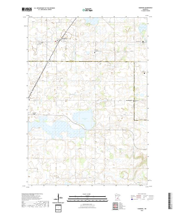
2022 Map of Hamburg
USGS Topo · Published 2022About this map
Hamburg and the small community of Assumption anchor this landscape in Carver County, where the topography is defined by glacial depressions and agricultural drainage systems. The map shows a complex network of wetlands and small water bodies, including Washington Lake, Erin Lake, and the aptly named Assumption Lake. The transition from natural drainage to engineered waterways is evident through features like Judicial Ditch Number Three and County Ditch Number Four, which channel water across the township lines toward Bevens Cr. This 2022 survey illustrates the persistence of these rural Minnesota settlements and their enduring relationship with the surrounding prairie-pothole terrain, providing a clear record of modern property boundaries, local road networks, and the hydrologic connections that have shaped the region's farming heritage for generations.
Find a feature on this map
10 named features on this map. Tap any name to fly to it.
Don’t see what you’re looking for? This feature index may not catch every label — zoom into the map to look around manually.
Map Details
Editions of this 2022 Hamburg Map
This is the sole edition of this map. No revisions or reprints were ever made.
Other maps of this area

1953 · Saint Paul
USGS Topo · 1:250,000

1953 · New Ulm
USGS Topo · 1:250,000

1957 · New Ulm
USGS Topo · 1:250,000

1957 · Belle Plaine
USGS Topo · 1:62,500

1957 · Waconia
USGS Topo · 1:62,500

1958 · New Ulm
USGS Topo · 1:250,000

1958 · Gaylord
USGS Topo · 1:62,500

1958 · Glencoe
USGS Topo · 1:62,500

1959 · Saint Paul
USGS Topo · 1:250,000

1967 · New Ulm
USGS Topo · 1:250,000