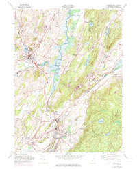
1954 Map of Hamburg
USGS Topo · Published 1974About this map
Papakating Creek and the Wallkill River converge near the boroughs of Sussex and Hamburg, defining a landscape of agricultural valleys and industrial corridors in mid-century Sussex County. This 1954 edition, with 1971 revisions, documents the infrastructure of a transitioning rural economy, featuring the Lehigh and Hudson River and Lehigh and New England railroads that served the region's mines and mills. Local landmarks like the Sussex Airport and a prominent Quarry near McAfee sit alongside established community centers such as Hardistonville, North Church, and Rudeville. For the genealogist, the map provides precise locations for numerous burial grounds, including Fairview Cem, Wantage Cem, and Union Cem. The presence of Township Sch and High Sch in Sussex further illustrates the settlement patterns of this corner of New Jersey during the early 1970s.
Find a feature on this map
53 named features on this map. Tap any name to fly to it.
Don’t see what you’re looking for? This feature index may not catch every label — zoom into the map to look around manually.
Map Details
Editions of this 1954 Hamburg Map
4 editions found
Other maps of this area

1888 · Franklin
USGS Topo · 1:62,500

1891 · Greenwood Lake
USGS Topo · 1:62,500

1893 · Greenwood Lake
USGS Topo · 1:62,500

1894 · Franklin
USGS Topo · 1:62,500

1897 · Franklin
USGS Topo · 1:62,500

1903 · Franklin Furnace
USGS Topo · 1:62,500

1903 · Greenwood Lake
USGS Topo · 1:62,500

1906 · Port Jervis
USGS Topo · 1:62,500

1906 · Goshen
USGS Topo · 1:62,500

1908 · Goshen
USGS Topo · 1:62,500
Featured Places
- Vernon Township, NJ
- Wantage, NJ
- Wantage Township, Vernon Township
- Franklin, Hardyston Township
- Hamburg, Hardyston Township