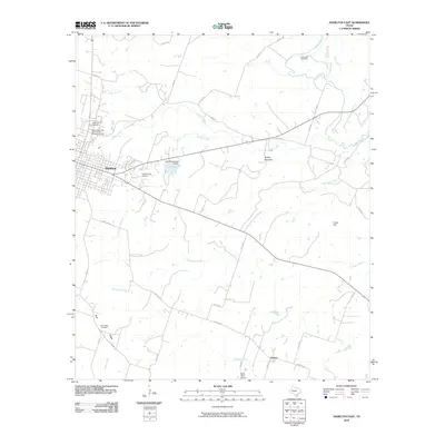
2010 Map of Hamilton East
USGS Topo · Published 2010About this map
Hamilton serves as the focal point of this Central Texas landscape, established near the banks of Pecan Creek and the City of Hamilton Dam. The town’s grid gives way to a network of county roads that navigate a terrain marked by distinctive elevations like Cheyenne Mesa and Dooley Mountain. To the southeast, the small community of Aleman is anchored by Saint Pauls School and several rural thoroughfares.
Find a feature on this map
42 named features on this map. Tap any name to fly to it.
Don’t see what you’re looking for? This feature index may not catch every label — zoom into the map to look around manually.
Map Details
Editions of this 2010 Hamilton East Map
This is the sole edition of this map. No revisions or reprints were ever made.
Other maps of this area

1888 · Hamilton
USGS Topo · 1:125,000

1888 · Meridian
USGS Topo · 1:125,000

1894 · Hamilton
USGS Topo · 1:125,000

1894 · Meridian
USGS Topo · 1:125,000

1954 · Brownwood
USGS Topo · 1:250,000

1954 · Waco
USGS Topo · 1:250,000

1955 · Waco
USGS Topo · 1:250,000
1956 · Jonesboro
USGS Topo · 1:24,000

1956 · Gentrys Mill
USGS Topo · 1:24,000
1956 · Ohio
USGS Topo · 1:24,000