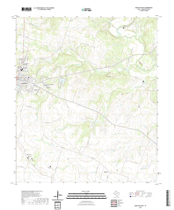
2022 Map of Hamilton East
USGS Topo · Published 2022About this map
The town of Hamilton serves as the hub of this Central Texas landscape, where the Hamilton County Courthouse stands at the center of a grid defined by streets like E Main St and Jonesboro Rd. The area’s genealogical record is remarkably dense, featuring an extensive cluster of burial grounds including Oakwood Cem, New Independent Order of Odd Fellows Cem, and the Old Independent Order of Odd Fellows Cem. These sites, along with the Graves-Gentry Cem, provide a deep ledger of the community's ancestral roots.
Find a feature on this map
72 named features on this map. Tap any name to fly to it.
Don’t see what you’re looking for? This feature index may not catch every label — zoom into the map to look around manually.
Map Details
Editions of this 2022 Hamilton East Map
This is the sole edition of this map. No revisions or reprints were ever made.
Other maps of this area

1888 · Hamilton
USGS Topo · 1:125,000

1888 · Meridian
USGS Topo · 1:125,000

1894 · Hamilton
USGS Topo · 1:125,000

1894 · Meridian
USGS Topo · 1:125,000

1954 · Brownwood
USGS Topo · 1:250,000

1954 · Waco
USGS Topo · 1:250,000

1955 · Waco
USGS Topo · 1:250,000
1956 · Jonesboro
USGS Topo · 1:24,000

1956 · Gentrys Mill
USGS Topo · 1:24,000
1956 · Ohio
USGS Topo · 1:24,000