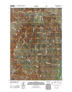
2011 Map of Hamilton
USGS Topo · Published 2011About this map
Hamilton and Courtrock anchor this survey of the Grant County high country, where the landscape is defined by a series of prominent peaks and deep drainage basins. The settlement of Hamilton sits near the northern boundary at the confluence of several branches of Deer Creek, including the West Fork Deer Creek and East Fork Deer Creek. Significant topographic landmarks such as Sunken Mountain and Hamilton Mountain overlook the various canyons that carve through the region, including Sweek Canyon and Merrill Canyon. Evidence of early community life is preserved through labels for the Hamilton Cemetery and Schoolhouse Hill, while the remote southern reaches are marked by Eagle Rock and the winding course of Camp Creek. The map details a network of rural routes, notably the Kimberly Long Creek Hwy and the Monument to Courtrock Rd, which historically connected these isolated ranching and homesteading locales.
Find a feature on this map
26 named features on this map. Tap any name to fly to it.
Don’t see what you’re looking for? This feature index may not catch every label — zoom into the map to look around manually.
Map Details
Editions of this 2011 Hamilton Map
This is the sole edition of this map. No revisions or reprints were ever made.
Other maps of this area

1949 · Long Creek
USGS Topo · 1:62,500

1950 · Ritter
USGS Topo · 1:62,500

1951 · Long Creek
USGS Topo · 1:62,500

1951 · Courtrock
USGS Topo · 1:62,500

1951 · Monument
USGS Topo · 1:62,500

1952 · Ritter
USGS Topo · 1:62,500

1955 · Canyon City
USGS Topo · 1:250,000

1959 · Canyon City
USGS Topo · 1:250,000

1980 · Monument
USGS Topo · 1:100,000
1990 · Donaldson Creek
USGS Topo · 1:24,000