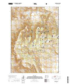
2020 Map of Hamilton
USGS Topo · Published 2020About this map
Hamilton and the small settlement of Courtrock anchor this survey of the high-elevation terrain in Grant County. The landscape is defined by its dramatic relief, where Sunken Mtn and Hamilton Mtn rise above a series of deep drainages including Sweek Canyon, Merrill Canyon, and Smokers Canyon. These water-carved features feed into a network of creeks such as E Fork Cottonwood Cr and W Fork Deer Cr. For those tracing local heritage, the Hamilton Cem sits near the northern boundary, while much of the central and eastern portions of the map are protected within the Malheur National Forest.
Find a feature on this map
36 named features on this map. Tap any name to fly to it.
Don’t see what you’re looking for? This feature index may not catch every label — zoom into the map to look around manually.
Map Details
Editions of this 2020 Hamilton Map
This is the sole edition of this map. No revisions or reprints were ever made.
Other maps of this area

1949 · Long Creek
USGS Topo · 1:62,500

1950 · Ritter
USGS Topo · 1:62,500

1951 · Long Creek
USGS Topo · 1:62,500

1951 · Courtrock
USGS Topo · 1:62,500

1951 · Monument
USGS Topo · 1:62,500

1952 · Ritter
USGS Topo · 1:62,500

1955 · Canyon City
USGS Topo · 1:250,000

1959 · Canyon City
USGS Topo · 1:250,000

1980 · Monument
USGS Topo · 1:100,000
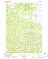
1990 · Donaldson Creek
USGS Topo · 1:24,000