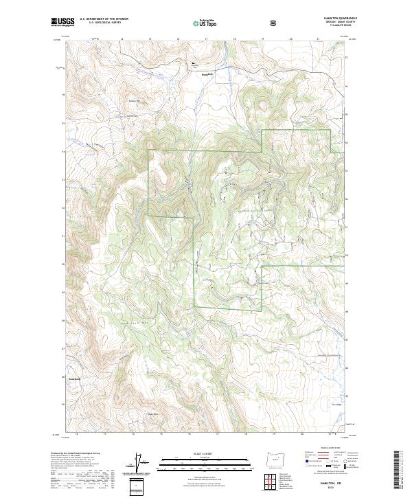
2023 Map of Hamilton
USGS Topo · Published 2023About this map
Hamilton and the small outpost of Courtrock serve as the primary human markers in this high-altitude landscape of Grant County. The area is defined by the convergence of several drainages, including East Fork Cottonwood Creek and the multiple forks of Deer Creek, which carve through the high ground of Sunken Mtn and Hamilton Mtn. Genealogy researchers will find the Hamilton Cem located just north of the settlement, a key landmark for local history in this remote portion of Oregon.
Find a feature on this map
35 named features on this map. Tap any name to fly to it.
Don’t see what you’re looking for? This feature index may not catch every label — zoom into the map to look around manually.
Map Details
Editions of this 2023 Hamilton Map
This is the sole edition of this map. No revisions or reprints were ever made.
Other maps of this area

1949 · Long Creek
USGS Topo · 1:62,500

1950 · Ritter
USGS Topo · 1:62,500

1951 · Long Creek
USGS Topo · 1:62,500

1951 · Courtrock
USGS Topo · 1:62,500

1951 · Monument
USGS Topo · 1:62,500

1952 · Ritter
USGS Topo · 1:62,500

1955 · Canyon City
USGS Topo · 1:250,000

1959 · Canyon City
USGS Topo · 1:250,000

1980 · Monument
USGS Topo · 1:100,000
1990 · Donaldson Creek
USGS Topo · 1:24,000