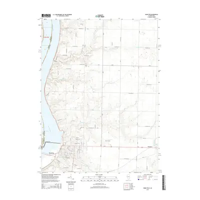
2015 Map of Hamilton
USGS Topo · Published 2015About this map
The Keokuk Dam and the expansive waters of Pool 19 dominate the western edge of this 2015 survey, marking the vital industrial and navigational corridor of the Mississippi River between Illinois and Iowa. The city of Hamilton serves as a primary hub, showing a detailed street grid including Main St and Broadway St, alongside established local landmarks like Greenwood Cem and Oakwood Cem.
Find a feature on this map
80 named features on this map. Tap any name to fly to it.
Don’t see what you’re looking for? This feature index may not catch every label — zoom into the map to look around manually.
Map Details
Editions of this 2015 Hamilton Map
This is the sole edition of this map. No revisions or reprints were ever made.
Other maps of this area

1932 · Lomax
USGS Topo · 1:62,500

1933 · Carthage
USGS Topo · 1:62,500

1936 · Keokuk
USGS Topo · 1:62,500

1936 · Fort Madison
USGS Topo · 1:62,500

1937 · Carthage
USGS Topo · 1:62,500

1937 · Lomax
USGS Topo · 1:62,500

1950 · Keokuk
USGS Topo · 1:62,500

1958 · Burlington
USGS Topo · 1:250,000

1961 · Burlington
USGS Topo · 1:250,000

1963 · Burlington
USGS Topo · 1:250,000