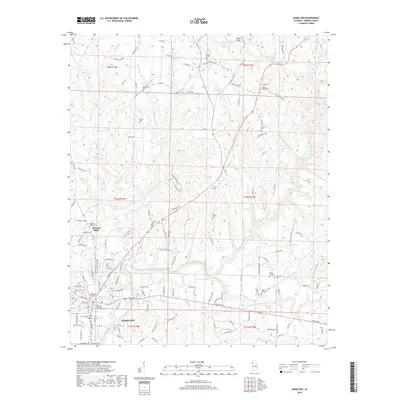
2018 Map of Hamilton
USGS Topo · Published 2018About this map
Hamilton serves as the focal point of this Marion County landscape, situated where Alabama Highway 187 and US Highway 43 and 278 converge. The Buttahatchee River meanders across the southern portion of the quadrangle, joined by numerous tributaries including Williams Creek and Sevenmile Creek. This network of waterways historically influenced the placement of early settlements and roads, creating a pattern of land use that remains evident in the contemporary topography.
Find a feature on this map
167 named features on this map. Tap any name to fly to it.
Don’t see what you’re looking for? This feature index may not catch every label — zoom into the map to look around manually.
Map Details
Editions of this 2018 Hamilton Map
This is the sole edition of this map. No revisions or reprints were ever made.
Other maps of this area

1936 · Hodges
USGS Topo · 1:24,000

1936 · South Of Hackleburg
USGS Topo · 1:24,000

1936 · Hackleburg
USGS Topo · 1:24,000

1936 · Vina
USGS Topo · 1:24,000

1946 · Hackleburg
USGS Topo · 1:24,000
1948 · Hackleburg
USGS Topo · 1:24,000

1949 · Hodges
USGS Topo · 1:24,000

1950 · Vina
USGS Topo · 1:24,000

1951 · Vina
USGS Topo · 1:24,000

1956 · Gadsden
USGS Topo · 1:250,000