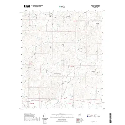
2020 Map of Hamilton NE
USGS Topo · Published 2020About this map
Hackleburg and the surrounding Marion County uplands are defined by the winding course of the Buttahatchee River and the significant geographic boundary of the Tennessee Valley Divide. This 2020 survey reveals a landscape where local history is anchored by numerous family and community cemeteries, such as Burleson Cem, Old Bethel Cem, and Sullins Cem, which are scattered across the rural terrain. The topography is deeply dissected by a network of waterways including Camp Cr, Barn Cr, and Clifty Cr, creating a complex of ridges and hollows like Brush Creek Hollow.
Find a feature on this map
77 named features on this map. Tap any name to fly to it.
Don’t see what you’re looking for? This feature index may not catch every label — zoom into the map to look around manually.
Map Details
Editions of this 2020 Hamilton NE Map
This is the sole edition of this map. No revisions or reprints were ever made.
Other maps of this area

1936 · Hodges
USGS Topo · 1:24,000

1936 · Phil Campbell
USGS Topo · 1:24,000

1936 · South Of Hackleburg
USGS Topo · 1:24,000

1936 · Hackleburg
USGS Topo · 1:24,000

1936 · Goddard
USGS Topo · 1:24,000

1946 · Hackleburg
USGS Topo · 1:24,000

1946 · Phil Campbell
USGS Topo · 1:24,000

1947 · Phil Campbell
USGS Topo · 1:24,000
1948 · Hackleburg
USGS Topo · 1:24,000

1949 · Hodges
USGS Topo · 1:24,000