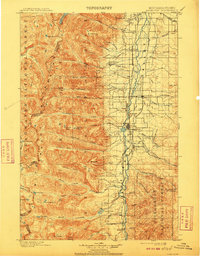
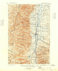
1901 Map of Hamilton
USGS Topo · Published 1910About this map
Hamilton serves as the central hub of this early 20th-century landscape, where the Northern Pacific Railway Bitterroot Branch dictates the settlement pattern along the valley floor. The map captures a period of active resource extraction and early community infrastructure, evidenced by industrial sites like the Curlew Mines and the Bluebird Mine near Victor. Education and leisure also have their place in this developing frontier, marked by the Pleasantview School and the Weeping Child Hot Springs. To the west, the formidable Bitterroot Mountains rise sharply, their drainage represented by a complex network of creeks including Lost Horse Creek and Blodgett Creek. This survey provides a clear look at the valley's transition from the wild terrain of the Bitterroot National Forest to the organized agricultural and mining districts around Grantsdale and Corvallis.
Find a feature on this map
90 named features on this map. Tap any name to fly to it.
Don’t see what you’re looking for? This feature index may not catch every label — zoom into the map to look around manually.
Map Details
Editions of this 1901 Hamilton Map
6 editions found
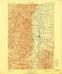
Other maps of this area

1901 · Hamilton
USGS Topo · 1:125,000

1903 · Bonner
USGS Topo · 1:125,000

1909 · Sapphire
USGS Topo · 1:125,000

1911 · Lolo
USGS Topo · 1:250,000

1912 · Missoula
USGS Topo · 1:125,000

1913 · Lolo
USGS Topo · 1:250,000

1947 · Butte
USGS Topo · 1:250,000

1955 · Dillon
USGS Topo · 1:250,000

1956 · Elk City
USGS Topo · 1:250,000

1956 · Hamilton
USGS Topo · 1:250,000