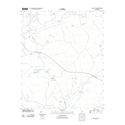
2011 Map of Hamilton SW
USGS Topo · Published 2011About this map
Pikeville and the surrounding Marion County countryside are defined by a network of family cemeteries and localized energy extraction. This 2011 survey illustrates a landscape where traditional rural settlements like Stinson and Maywood Camp sit alongside modern industrial footprints, including the Hamilton Gas Field and Woods Creek Gas Field. The topography is etched by numerous watercourses such as the Buttahatchee River and Dugan Creek, which flow toward County Lake, held by the Marion County Public Lake Dam. For genealogists, the map is particularly detailed, locating several burial grounds such as Philadelphia Cemetery, Banister Cemetery, and Liberty Cemetery. The presence of Dug Hill Gas Field in the south underscores the area's continued reliance on natural resource development within its historically agricultural valleys.
Find a feature on this map
80 named features on this map. Tap any name to fly to it.
Don’t see what you’re looking for? This feature index may not catch every label — zoom into the map to look around manually.
Map Details
Editions of this 2011 Hamilton SW Map
This is the sole edition of this map. No revisions or reprints were ever made.
Other maps of this area

1936 · South Of Hackleburg
USGS Topo · 1:24,000

1953 · Birmingham
USGS Topo · 1:250,000

1953 · West Point
USGS Topo · 1:250,000

1956 · Birmingham
USGS Topo · 1:250,000

1956 · Gadsden
USGS Topo · 1:250,000

1956 · Tupelo
USGS Topo · 1:250,000

1957 · Birmingham
USGS Topo · 1:250,000

1958 · Tupelo
USGS Topo · 1:250,000

1958 · West Point
USGS Topo · 1:250,000

1958 · Gadsden
USGS Topo · 1:250,000