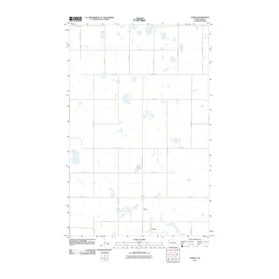
2011 Map of Hamlet
USGS Topo · Published 2011About this map
Hamlet anchors the southeastern corner of this North Dakota landscape, situated along the intersection of County Hwy-19 and several local section lines. This 2011 survey reveals a classic prairie grid system defined by routes such as 111th Ave NW and 87th St NW, which segment the terrain into precise agricultural blocks. The geography is notably dotted with numerous small prairie potholes and wetlands, with Jensen Lake serving as a significant localized water feature in the central portion of the quadrangle. For those researching local heritage or family history, the Trinity Cemetery stands as a primary landmark north of the settlement, providing a genealogical anchor for this sparsely populated region of Williams County. The map captures the quiet, organized character of the high plains, where infrastructure is dictated by the township and range system.
Find a feature on this map
20 named features on this map. Tap any name to fly to it.
Don’t see what you’re looking for? This feature index may not catch every label — zoom into the map to look around manually.
Map Details
Editions of this 2011 Hamlet Map
This is the sole edition of this map. No revisions or reprints were ever made.
Other maps of this area

1949 · Columbus SW
USGS Topo · 1:24,000

1949 · Noonan SW
USGS Topo · 1:24,000

1949 · Noonan SE
USGS Topo · 1:24,000

1950 · Columbus
USGS Topo · 1:62,500

1950 · Noonan
USGS Topo · 1:62,500

1953 · Williston
USGS Topo · 1:250,000

1957 · Williston
USGS Topo · 1:250,000

1974 · Wildrose
USGS Topo · 1:24,000

1974 · Tom Berg Lake
USGS Topo · 1:24,000

1974 · Hamlet
USGS Topo · 1:24,000