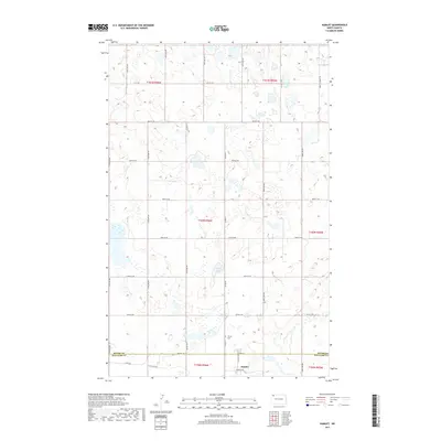
2017 Map of Hamlet
USGS Topo · Published 2017About this map
Hamlet sits near the southern edge of this landscape, positioned just below the boundary line where Divide Co Williams Co meet. The area is characterized by the prairie pothole region's distinct hydrography, with numerous small, unnamed wetlands scattered across the sections surrounding Jensen Lake. This late-era survey documents a rural infrastructure defined by a rigid grid of section-line roads, including Farm to Market Rd and Co Hwy 14, which serve the expansive agricultural tracts of the Missouri Plateau. Local history is anchored by Trinity Cem in the southern portion of the quadrangle, a landmark that remains a vital point of reference for researchers tracing the early 21st-century footprint of this corner of the state. The map provides a clear record of the intersection between human transit and the natural drainage patterns of northwestern North Dakota.
Find a feature on this map
31 named features on this map. Tap any name to fly to it.
Don’t see what you’re looking for? This feature index may not catch every label — zoom into the map to look around manually.
Map Details
Editions of this 2017 Hamlet Map
This is the sole edition of this map. No revisions or reprints were ever made.
Other maps of this area

1949 · Columbus SW
USGS Topo · 1:24,000

1949 · Noonan SW
USGS Topo · 1:24,000

1949 · Noonan SE
USGS Topo · 1:24,000

1950 · Columbus
USGS Topo · 1:62,500

1950 · Noonan
USGS Topo · 1:62,500

1953 · Williston
USGS Topo · 1:250,000

1957 · Williston
USGS Topo · 1:250,000

1974 · Wildrose
USGS Topo · 1:24,000

1974 · Tom Berg Lake
USGS Topo · 1:24,000

1974 · Hamlet
USGS Topo · 1:24,000