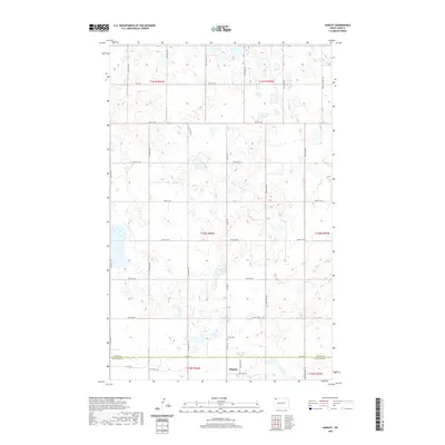
2020 Map of Hamlet
USGS Topo · Published 2020About this map
Hamlet sits at the intersection of a vast grid of section lines and county roads at the border of Divide and Williams counties. This prairie landscape is defined by its agricultural layout and glacial potholes, with water bodies like Jensen Lake and the low-lying area simply labeled The Swamp providing the only break in the uniform township and range system. The settlement of Hamlet itself is centered near 83rd Ln NW and 109th Dr NW, south of the primary east-west route, Co Hwy 14.
Find a feature on this map
33 named features on this map. Tap any name to fly to it.
Don’t see what you’re looking for? This feature index may not catch every label — zoom into the map to look around manually.
Map Details
Editions of this 2020 Hamlet Map
This is the sole edition of this map. No revisions or reprints were ever made.
Other maps of this area

1949 · Columbus SW
USGS Topo · 1:24,000

1949 · Noonan SW
USGS Topo · 1:24,000

1949 · Noonan SE
USGS Topo · 1:24,000

1950 · Columbus
USGS Topo · 1:62,500

1950 · Noonan
USGS Topo · 1:62,500

1953 · Williston
USGS Topo · 1:250,000

1957 · Williston
USGS Topo · 1:250,000

1974 · Wildrose
USGS Topo · 1:24,000

1974 · Tom Berg Lake
USGS Topo · 1:24,000

1974 · Hamlet
USGS Topo · 1:24,000