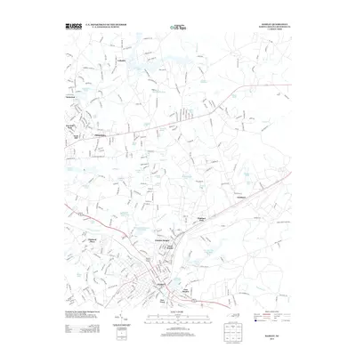
2013 Map of Hamlet
USGS Topo · Published 2013About this map
Hamlet and its surrounding neighborhoods anchor this Richmond County landscape, illustrating a dense network of suburban development and industrial heritage. The rail lines of the CSX corridor bisect the region, connecting the primary settlement of Hamlet with its distinct residential extensions such as North Hamlet, East Hamlet, and New Town. To the north, the terrain is defined by an extensive system of impoundments and creeks, including Ledbetter Lake at the settlement of Ledbetter, and Gibsons Millpond along Hitchcock Cr. These water bodies, alongside Hinson Lake and Roberdel Pond, suggest a history of water-powered industry and local recreation. Educational and social foundations are represented by the Richmond Technical Institute and centers of worship like Mount Olive Church, while the municipal boundaries of Dobbins Heights and Highland Park show the twentieth-century growth of the area beyond the central rail hub.
Find a feature on this map
316 named features on this map. Tap any name to fly to it.
Don’t see what you’re looking for? This feature index may not catch every label — zoom into the map to look around manually.
Map Details
Editions of this 2013 Hamlet Map
This is the sole edition of this map. No revisions or reprints were ever made.
Other maps of this area

1942 · Troy
USGS Topo · 1:125,000

1942 · Rockingham
USGS Topo · 1:125,000

1949 · Gibson
USGS Topo · 1:24,000

1949 · Millstone Lake
USGS Topo · 1:24,000

1949 · Ghio
USGS Topo · 1:24,000

1949 · Hoffman
USGS Topo · 1:24,000

1949 · Marston
USGS Topo · 1:24,000

1949 · Hamlet
USGS Topo · 1:24,000

1949 · Hamlet
USGS Topo · 1:62,500

1949 · Jackson Springs
USGS Topo · 1:62,500