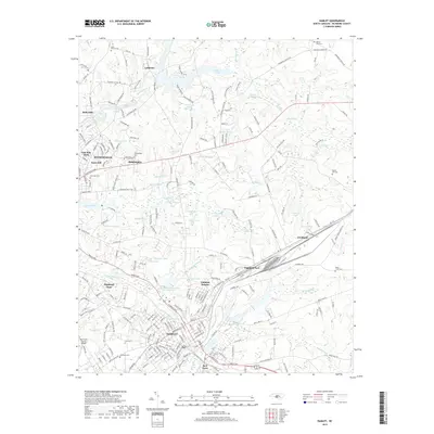
2019 Map of Hamlet
USGS Topo · Published 2019About this map
The rail-driven landscape of Hamlet and Rockingham is clearly defined in this Richmond County survey, centered on the complex convergence of the Csx Dr line. The map illustrates the region's historical reliance on millponds and small water bodies for industry and community life, with features like Gibsons Millpond, Ledbetter Lake, and Morgans Pond dotting the terrain. Residential expansion is evident in the layout of Dobbins Heights, Highland Park, and East Side Park, while the rural character of the surrounding county is preserved through numerous family and community burial grounds, including Philadelphia Cem and Hopewell Cem. This detailed geography captures the transition between the dense urban railroad hubs and the more dispersed settlements of Fruitland and Ledbetter, providing a comprehensive look at the infrastructure that supported these North Carolina communities into the late 20th century.
Find a feature on this map
60 named features on this map. Tap any name to fly to it.
Don’t see what you’re looking for? This feature index may not catch every label — zoom into the map to look around manually.
Map Details
Editions of this 2019 Hamlet Map
This is the sole edition of this map. No revisions or reprints were ever made.
Other maps of this area

1942 · Troy
USGS Topo · 1:125,000

1942 · Rockingham
USGS Topo · 1:125,000

1949 · Gibson
USGS Topo · 1:24,000

1949 · Millstone Lake
USGS Topo · 1:24,000

1949 · Ghio
USGS Topo · 1:24,000

1949 · Hoffman
USGS Topo · 1:24,000

1949 · Marston
USGS Topo · 1:24,000

1949 · Hamlet
USGS Topo · 1:24,000

1949 · Hamlet
USGS Topo · 1:62,500

1949 · Jackson Springs
USGS Topo · 1:62,500