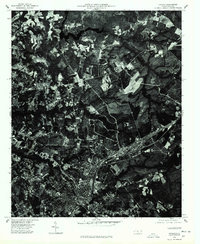
1976 Map of Hamlet
USGS Topo · Published 1978About this map
Ledbetter Lake stretches across the northern portion of this orthophotoquad, serving as a prominent landmark in the landscape of Richmond County during the mid-1970s. This aerial perspective, captured in early 1976, reveals the intricate land use patterns surrounding the settlement of Ledbetter. The imagery shows a clear distinction between the dense woodland and the clearing for agriculture and infrastructure, providing an unfiltered view of the area's development before modern expansion. This specific type of survey, a joint effort between the U.S. Geological Survey and the North Carolina Department of Natural and Economic Resources, offers researchers a precise visual record of the ground cover and transportation networks as they existed during this era.
Find a feature on this map
2 named features on this map. Tap any name to fly to it.
Don’t see what you’re looking for? This feature index may not catch every label — zoom into the map to look around manually.
Map Details
Editions of this 1976 Hamlet Map
This is the sole edition of this map. No revisions or reprints were ever made.
Other maps of this area

1942 · Troy
USGS Topo · 1:125,000

1942 · Rockingham
USGS Topo · 1:125,000

1949 · Gibson
USGS Topo · 1:24,000

1949 · Millstone Lake
USGS Topo · 1:24,000

1949 · Ghio
USGS Topo · 1:24,000

1949 · Hoffman
USGS Topo · 1:24,000

1949 · Marston
USGS Topo · 1:24,000

1949 · Hamlet
USGS Topo · 1:24,000

1949 · Hamlet
USGS Topo · 1:62,500

1949 · Jackson Springs
USGS Topo · 1:62,500