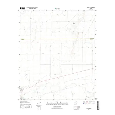
2016 Map of Hamlin NE
USGS Topo · Published 2016About this map
Hamlin serves as the primary urban anchor on the edge of this West Texas landscape, where the survey captures the intersection of local industry and the natural drainage systems of Jones and Stonewall Counties. The land is defined by the winding paths of California Cr and Dry California Cr in the south, while Paint Cr cuts across the northern reaches near the small settlement of Pastura. A significant topographical landmark, Flat Top Mtn, rises in the northeast, providing a distinct break in the otherwise steady grid of county roads and farm-to-market routes like FM 1835 and FM 2834. Genealogists and local historians will find the East Cem situated just east of the main town site, offering a specific point of interest for tracing family roots in this rural ranching and farming corridor.
Find a feature on this map
39 named features on this map. Tap any name to fly to it.
Don’t see what you’re looking for? This feature index may not catch every label — zoom into the map to look around manually.
Map Details
Editions of this 2016 Hamlin NE Map
This is the sole edition of this map. No revisions or reprints were ever made.
Other maps of this area

1891 · Anson
USGS Topo · 1:125,000

1893 · Roby
USGS Topo · 1:125,000

1893 · Anson
USGS Topo · 1:125,000

1931 · Aspermont
USGS Topo · 1:62,500

1954 · Lubbock
USGS Topo · 1:250,000

1954 · Big Spring
USGS Topo · 1:250,000

1954 · Abilene
USGS Topo · 1:250,000

1954 · Wichita Falls
USGS Topo · 1:250,000

1958 · Big Spring
USGS Topo · 1:250,000

1958 · Wichita Falls
USGS Topo · 1:250,000