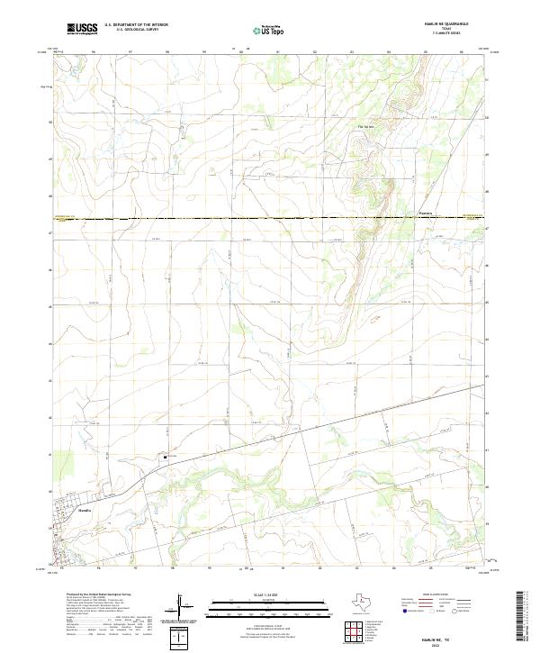
2022 Map of Hamlin NE
USGS Topo · Published 2022About this map
Hamlin sits at the southwestern edge of this landscape, where the street grid of NE 3rd St and NE Ave C gives way to the open ranchland of the Texas Rolling Plains. The terrain is defined by the winding course of California Cr and its tributary, Dry California Cr, which carve through the low-lying draws between isolated heights. To the north, the prominent rise of Flat Top Mtn overlooks the rural settlement of Pastura near the border of Stonewall and Jones counties.
Find a feature on this map
42 named features on this map. Tap any name to fly to it.
Don’t see what you’re looking for? This feature index may not catch every label — zoom into the map to look around manually.
Map Details
Editions of this 2022 Hamlin NE Map
This is the sole edition of this map. No revisions or reprints were ever made.
Other maps of this area

1891 · Anson
USGS Topo · 1:125,000

1893 · Roby
USGS Topo · 1:125,000

1893 · Anson
USGS Topo · 1:125,000

1931 · Aspermont
USGS Topo · 1:62,500

1954 · Lubbock
USGS Topo · 1:250,000

1954 · Big Spring
USGS Topo · 1:250,000

1954 · Abilene
USGS Topo · 1:250,000

1954 · Wichita Falls
USGS Topo · 1:250,000

1958 · Big Spring
USGS Topo · 1:250,000

1958 · Wichita Falls
USGS Topo · 1:250,000