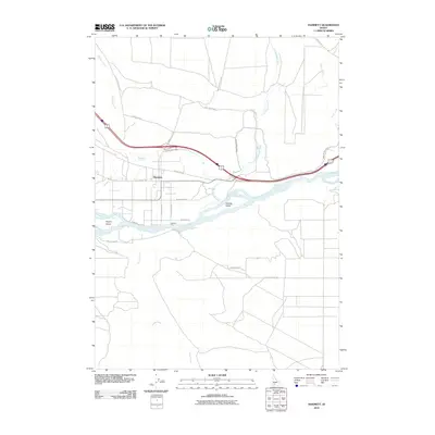
2010 Map of Hammett
USGS Topo · Published 2010About this map
Hammett stands as the primary settlement in this Elmore County landscape, where irrigation infrastructure like the King Hill Main Canal transformed the arid terrain along the Snake River. The map documents a critical transportation corridor, showing the alignment of Old Highway 30 alongside modern interstate developments. Historically significant river crossings are noted, specifically the site of Medbury Ferry near Sparlin Island. The area's hydrology is defined by the braided path of the river, featuring substantial landforms like Schoffs Island, and a network of seasonal drainages including Bennett Creek, Cold Springs Creek, and Sailor Creek. Local transit is characterized by winding routes such as Wilson Grade, which navigates the elevation changes south of the river, and agricultural access roads like S Humphreys Rd and W Spangler Rd that serve the rural valley floor.
Find a feature on this map
25 named features on this map. Tap any name to fly to it.
Don’t see what you’re looking for? This feature index may not catch every label — zoom into the map to look around manually.
Map Details
Editions of this 2010 Hammett Map
This is the sole edition of this map. No revisions or reprints were ever made.
Other maps of this area

1892 · Mountain Home
USGS Topo · 1:125,000

1892 · Camas Prairie
USGS Topo · 1:125,000

1893 · Mountain Home
USGS Topo · 1:125,000

1893 · Camas Prairie
USGS Topo · 1:125,000

1947 · Indian Cove
USGS Topo · 1:24,000

1947 · Hammett
USGS Topo · 1:24,000

1947 · Glenns Ferry
USGS Topo · 1:24,000

1948 · Hammett
USGS Topo · 1:24,000

1948 · Glenns Ferry
USGS Topo · 1:24,000

1948 · Indian Cove
USGS Topo · 1:24,000