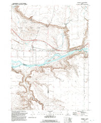
1992 Map of Hammett
USGS Topo · Published 1992About this map
Snake River geography dominates this area of Idaho, where the river carves through high desert terrain and forms distinctive features like Schoffs Island and The Narrows. The settlement of Hammett sits at a critical junction of transportation history, where the Union Pacific railroad and Old Highway 30 parallel the river's course. This intersection of rail and road reflects the long-standing importance of this corridor for movement through the Snake River Plain.
Find a feature on this map
32 named features on this map. Tap any name to fly to it.
Don’t see what you’re looking for? This feature index may not catch every label — zoom into the map to look around manually.
Map Details
Editions of this 1992 Hammett Map
This is the sole edition of this map. No revisions or reprints were ever made.
Other maps of this area

1892 · Mountain Home
USGS Topo · 1:125,000

1892 · Camas Prairie
USGS Topo · 1:125,000

1893 · Mountain Home
USGS Topo · 1:125,000

1893 · Camas Prairie
USGS Topo · 1:125,000

1947 · Indian Cove
USGS Topo · 1:24,000

1947 · Hammett
USGS Topo · 1:24,000

1947 · Glenns Ferry
USGS Topo · 1:24,000

1948 · Hammett
USGS Topo · 1:24,000

1948 · Glenns Ferry
USGS Topo · 1:24,000

1948 · Indian Cove
USGS Topo · 1:24,000