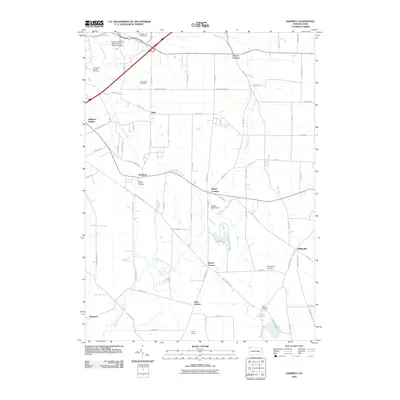
2010 Map of Hammett
USGS Topo · Published 2010About this map
Hammett serves as a central junction in this rural landscape, where several major local roads converge near the Mount Calvary Cemetery. The terrain is defined by the headwaters of numerous waterways, notably the Fourmile Creek and Sixmile Creek flowing north toward the lake, while the East Branch LeBoeuf Creek drains the southern fields. The presence of several named road intersections, such as Bogus Corners, Weeds Corners, and Yaple Corners, reflects a traditional crossroads settlement pattern typical of Erie County. To the north, the Behrend Campus Pennsylvania State University marks a shift toward institutional land use, while landmarks like the Kuhl Road Speedway and Gospel Hill Golf Course indicate local recreation hubs. In the southeast, the area around Lake Pleasant and its namesake Lake Pleasant Corners remains a distinct topographical low point, managed in part by the Siegel Marsh Dam to the north.
Find a feature on this map
78 named features on this map. Tap any name to fly to it.
Don’t see what you’re looking for? This feature index may not catch every label — zoom into the map to look around manually.
Map Details
Editions of this 2010 Hammett Map
This is the sole edition of this map. No revisions or reprints were ever made.
Other maps of this area

1899 · Erie
USGS Topo · 1:62,500

1900 · Erie
USGS Topo · 1:62,500

1913 · North East
USGS Topo · 1:62,500

1915 · North East
USGS Topo · 1:62,500

1923 · Cambridge Springs
USGS Topo · 1:62,500

1925 · Cambridge Springs
USGS Topo · 1:62,500

1929 · Union City
USGS Topo · 1:62,500

1932 · Union City
USGS Topo · 1:62,500

1943 · North East
USGS Topo · 1:62,500

1943 · Cambridge Springs
USGS Topo · 1:62,500