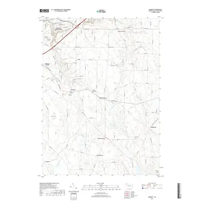
2019 Map of Hammett
USGS Topo · Published 2019About this map
Penn State Erie (Behrend) occupies the northwestern corner of this landscape, where modern academic infrastructure meets the deeply carved ravines of the lake plain. Moving southeast, the terrain transitions into a patchwork of rural hamlets and agricultural crossroads, including Hammett, Bogus Corners, and Weeds Corners. The area is defined by its numerous small burial grounds and parish centers, such as Saint Boniface Cem and Saint Pauls Evangelical Church, which reflect the long-standing community foundations in Erie County. The hydrology of the region is dominated by northward-flowing streams like Fourmile Cr and Sixmile Cr, while the southern reaches contain the headwaters of the E Br LeBoeuf Cr. This network of creeks has historically influenced the placement of early roads like Wattsburg RD, which remains a primary artery through the rolling terrain.
Find a feature on this map
103 named features on this map. Tap any name to fly to it.
Don’t see what you’re looking for? This feature index may not catch every label — zoom into the map to look around manually.
Map Details
Editions of this 2019 Hammett Map
This is the sole edition of this map. No revisions or reprints were ever made.
Other maps of this area

1899 · Erie
USGS Topo · 1:62,500

1900 · Erie
USGS Topo · 1:62,500

1913 · North East
USGS Topo · 1:62,500

1915 · North East
USGS Topo · 1:62,500

1923 · Cambridge Springs
USGS Topo · 1:62,500

1925 · Cambridge Springs
USGS Topo · 1:62,500

1929 · Union City
USGS Topo · 1:62,500

1932 · Union City
USGS Topo · 1:62,500

1943 · North East
USGS Topo · 1:62,500

1943 · Cambridge Springs
USGS Topo · 1:62,500