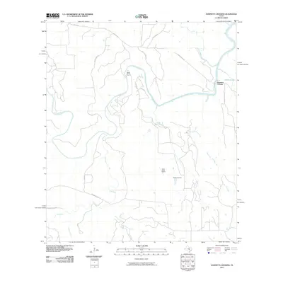
2010 Map of Hammetts Crossing
USGS Topo · Published 2010About this map
Pedernales River dominates this section of the Texas Hill Country, winding through a landscape defined by significant natural landmarks and ranching infrastructure. The waterway is punctuated by evocative crossing points such as Dead Mans Ford and the named Hammetts Crossing to the east. The presence of Dead Mans Hole and the popular Hamilton Pool suggests a terrain shaped by unique geological features and perennial water sources.
Find a feature on this map
28 named features on this map. Tap any name to fly to it.
Don’t see what you’re looking for? This feature index may not catch every label — zoom into the map to look around manually.
Map Details
Editions of this 2010 Hammetts Crossing Map
This is the sole edition of this map. No revisions or reprints were ever made.
Other maps of this area

1887 · Blanco
USGS Topo · 1:125,000

1894 · Blanco
USGS Topo · 1:125,000

1930 · Blanco-1
USGS Topo · 1:48,000

1954 · Llano
USGS Topo · 1:250,000

1955 · Llano
USGS Topo · 1:250,000

1956 · Llano
USGS Topo · 1:250,000
1963 · Dripping Springs
USGS Topo · 1:24,000

1963 · Yeager Creek
USGS Topo · 1:24,000
1963 · Henly
USGS Topo · 1:24,000
1967 · Pace Bend
USGS Topo · 1:24,000