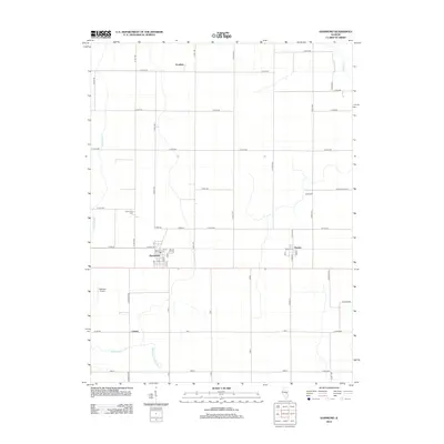
2012 Map of Hammond
USGS Topo · Published 2012About this map
Hammond and its surrounding agricultural landscape appear here in the early 21st century, centered on the intersection of Piatt, Moultrie, and Douglas counties. The village is defined by a tight grid of streets including 1st St, 3rd St, and S Main St, while the Hammond Cem sits just north along the N 750 E Rd corridor. To the east, the smaller settlement of Pierson anchors its own rural junction, and the remote station at Voorhies marks the northern extent of the quadrangle.
Find a feature on this map
49 named features on this map. Tap any name to fly to it.
Don’t see what you’re looking for? This feature index may not catch every label — zoom into the map to look around manually.
Map Details
Editions of this 2012 Hammond Map
This is the sole edition of this map. No revisions or reprints were ever made.
Other maps of this area

1935 · Arcola
USGS Topo · 1:48,000

1935 · Sullivan
USGS Topo · 1:48,000

1940 · Sullivan
USGS Topo · 1:62,500

1940 · Arcola
USGS Topo · 1:62,500

1950 · Tuscola
USGS Topo · 1:62,500

1955 · Bement
USGS Topo · 1:62,500

1958 · Decatur
USGS Topo · 1:250,000

1961 · Decatur
USGS Topo · 1:250,000
1975 · Tuscola NW
USGS Topo · 1:24,000
1975 · Tuscola SW
USGS Topo · 1:24,000