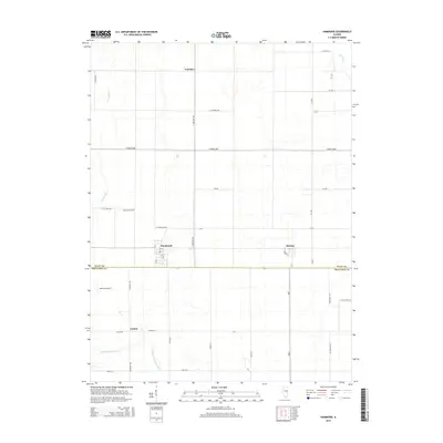
2015 Map of Hammond
USGS Topo · Published 2015About this map
Hammond and its surrounding agricultural landscape are defined by a meticulously engineered drainage network across the Piatt Co and Moultrie Co border. The map illustrates how human intervention has shaped this prairie region, visible through the linear paths of Ditch Number 4 and the Hammond Mutual Ditch, which channel water toward the Lake Fork. These water management systems support the fertile farmland that connects the small settlements of Voorhies in the north and Lanton in the south.
Find a feature on this map
43 named features on this map. Tap any name to fly to it.
Don’t see what you’re looking for? This feature index may not catch every label — zoom into the map to look around manually.
Map Details
Editions of this 2015 Hammond Map
This is the sole edition of this map. No revisions or reprints were ever made.
Other maps of this area

1935 · Arcola
USGS Topo · 1:48,000

1935 · Sullivan
USGS Topo · 1:48,000

1940 · Sullivan
USGS Topo · 1:62,500

1940 · Arcola
USGS Topo · 1:62,500

1950 · Tuscola
USGS Topo · 1:62,500

1955 · Bement
USGS Topo · 1:62,500

1958 · Decatur
USGS Topo · 1:250,000

1961 · Decatur
USGS Topo · 1:250,000
1975 · Tuscola NW
USGS Topo · 1:24,000
1975 · Tuscola SW
USGS Topo · 1:24,000