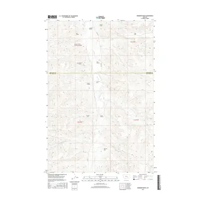
2017 Map of Hammond Ranch
USGS Topo · Published 2017About this map
The Tullock Creek valley dominates this portion of the Montana landscape, carving a primary corridor through the high plains north of the Treasure Co Big Horn Co line. This 2017 survey reveals a classic drainage-based settlement pattern, where habitable ground and ranching infrastructure cluster in protected depressions known as bottoms. Notable examples include Sullinger Bottom, Bird Bottom, and Turner Bottom, which provided the level terrain and water access necessary for operations like the Hammond Ranch.
Find a feature on this map
28 named features on this map. Tap any name to fly to it.
Don’t see what you’re looking for? This feature index may not catch every label — zoom into the map to look around manually.
Map Details
Editions of this 2017 Hammond Ranch Map
This is the sole edition of this map. No revisions or reprints were ever made.
Other maps of this area

1954 · Hardin
USGS Topo · 1:250,000

1954 · Forsyth
USGS Topo · 1:250,000

1957 · Hardin
USGS Topo · 1:250,000

1957 · Forsyth
USGS Topo · 1:250,000

1958 · Forsyth
USGS Topo · 1:250,000

1958 · Hardin
USGS Topo · 1:250,000

1960 · Marsh Coulee
USGS Topo · 1:24,000

1960 · Hope Ranch
USGS Topo · 1:24,000
1972 · The Dugout
USGS Topo · 1:24,000

1972 · Hammond Ranch
USGS Topo · 1:24,000