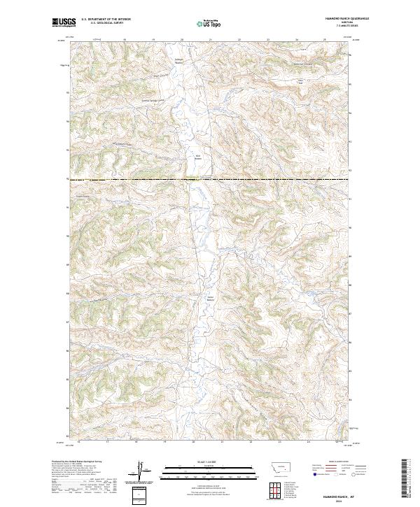
2024 Map of Hammond Ranch
USGS Topo · Published 2024About this map
Tullock Creek carves a central path through this Montana landscape, where the boundary between Treasure and Big Horn counties meets in a network of drainage basins and named flats. The topography is defined by significant coulees and bottoms, which often indicate the historical areas of most reliable water and grazing in this arid region. From the northern reaches at Sullinger Bottom to the southern expanse of Turner Bottom, these low-lying areas along the creek banks served as vital landmarks for local ranching operations.
Find a feature on this map
26 named features on this map. Tap any name to fly to it.
Don’t see what you’re looking for? This feature index may not catch every label — zoom into the map to look around manually.
Map Details
Editions of this 2024 Hammond Ranch Map
This is the sole edition of this map. No revisions or reprints were ever made.
Other maps of this area

1954 · Hardin
USGS Topo · 1:250,000

1954 · Forsyth
USGS Topo · 1:250,000

1957 · Hardin
USGS Topo · 1:250,000

1957 · Forsyth
USGS Topo · 1:250,000

1958 · Forsyth
USGS Topo · 1:250,000

1958 · Hardin
USGS Topo · 1:250,000

1960 · Marsh Coulee
USGS Topo · 1:24,000

1960 · Hope Ranch
USGS Topo · 1:24,000
1972 · The Dugout
USGS Topo · 1:24,000

1972 · Hammond Ranch
USGS Topo · 1:24,000