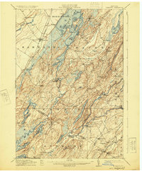
1912 Map of Hammond
USGS Topo · Published 1925About this map
Black Lake and its intricate shoreline of bays and islands dominate this northern New York landscape, which was surveyed between 1908 and 1910. The region is defined by a series of parallel ridges and narrow lakes, with the Oswegatchie River and Indian River cutting through the terrain. Evidence of early industrial activity and community life is widespread, from the Old Iron Works near the southern boundary to the numerous neighborhood schoolhouses like California School and Scotch Settlement School. In Rossie and Oxbow, the rivers served as vital corridors for early settlement, while the And R R railroad line connected villages such as Spragueville and Keene to the wider economy. The map preserves the placement of many small corners and stations, including Oakvale Sta and Chapel Corners, illustrating the dense network of rural hamlets that once populated St. Lawrence and Jefferson counties.
Find a feature on this map
79 named features on this map. Tap any name to fly to it.
Don’t see what you’re looking for? This feature index may not catch every label — zoom into the map to look around manually.
Map Details
Editions of this 1912 Hammond Map
4 editions found
Other maps of this area

1903 · Alexandria Bay
USGS Topo · 1:62,500

1903 · Theresa
USGS Topo · 1:62,500

1904 · Ogdensburg
USGS Topo · 1:62,500

1905 · Ogdensburg
USGS Topo · 1:62,500

1906 · Brier Hill
USGS Topo · 1:62,500

1911 · Antwerp
USGS Topo · 1:62,500

1912 · Hammond
USGS Topo · 1:62,500

1913 · Lake Bonaparte
USGS Topo · 1:62,500

1915 · Gouverneur
USGS Topo · 1:62,500

1916 · Lake Bonaparte
USGS Topo · 1:62,500