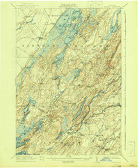
1912 Map of Hammond
USGS Topo · Published 1942About this map
The Oswegatchie River and the Grass River define this North Country landscape, where the early twentieth-century economy was driven by the water and the land. In the southern reaches, the Old Iron Works near Spragueville points to the area's industrial history, while a dense network of one-room schoolhouses like Scotch Settlement School, Bigelow School, and Stark School served the scattered rural communities.
Find a feature on this map
84 named features on this map. Tap any name to fly to it.
Don’t see what you’re looking for? This feature index may not catch every label — zoom into the map to look around manually.
Map Details
Editions of this 1912 Hammond Map
4 editions found
Other maps of this area

1903 · Alexandria Bay
USGS Topo · 1:62,500

1903 · Theresa
USGS Topo · 1:62,500

1904 · Ogdensburg
USGS Topo · 1:62,500

1905 · Ogdensburg
USGS Topo · 1:62,500

1906 · Brier Hill
USGS Topo · 1:62,500

1911 · Antwerp
USGS Topo · 1:62,500

1912 · Hammond
USGS Topo · 1:62,500

1913 · Lake Bonaparte
USGS Topo · 1:62,500

1915 · Gouverneur
USGS Topo · 1:62,500

1916 · Lake Bonaparte
USGS Topo · 1:62,500