
1970 Map of Hampden
USGS Topo · Published 1972About this map
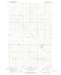
The town of Hampden serves as the primary hub of this 1970 landscape, situated at the junction of several section lines in the eastern portion of the survey. The terrain is characterized by a dense pattern of prairie potholes and wetlands, illustrating the glaciated topography common to Ramsey and Cavalier counties. Transportation and commerce are defined by the Burlington Northern railroad line, which runs diagonally through the area, connecting the small settlement of Weaver to the surrounding townships of Banner, Storlie, Northfield, and Royal. Local land use is reflected in features like the Storlie Cem and a Gravel Pit, providing tangible evidence of the community's early development and essential infrastructure during this era.
Find a feature on this map
12 named features on this map. Tap any name to fly to it.
Don’t see what you’re looking for? This feature index may not catch every label — zoom into the map to look around manually.
Map Details
Editions of this 1970 Hampden Map
2 editions found
Other maps of this area

1953 · Devils Lake
USGS Topo · 1:250,000

1956 · Devils Lake
USGS Topo · 1:250,000

1962 · Starkweather NE
USGS Topo · 1:24,000

1970 · Alsen
USGS Topo · 1:24,000

1970 · Loma
USGS Topo · 1:24,000

1970 · Alsen SE
USGS Topo · 1:24,000

1970 · Munich
USGS Topo · 1:24,000

1971 · Munich SE
USGS Topo · 1:24,000

1972 · Derrick NW
USGS Topo · 1:24,000

1972 · Derrick
USGS Topo · 1:24,000