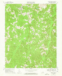
1968 Map of Hampden Sydney
USGS Topo · Published 1972About this map
Hampden-Sydney College anchors the northern portion of this Southside Virginia landscape, surrounded by the historic community of Hampden Sydney. The area exhibits a classic Piedmont settlement pattern, where small hubs like Kingsville, Worsham, and Redd Shop are linked by winding roads that follow the high ground between numerous watercourses. The drainage of the Bush River and Buffalo Creek carves a complex network of branches, including Tanyard Branch and Briery Branch, which dictated the placement of early homesteads and agricultural fields. Genealogists will find significant local landmarks such as Seminary Cem, Mercy Seat Ch, and Mt Pleasant Ch scattered throughout the quadrangle. The map also documents mid-century infrastructure like the Sewage Disposal facility and the recreational Farmville Lake, reflecting the intersection of long-standing rural traditions with modern development during the late 1960s.
Find a feature on this map
28 named features on this map. Tap any name to fly to it.
Don’t see what you’re looking for? This feature index may not catch every label — zoom into the map to look around manually.
Map Details
Editions of this 1968 Hampden Sydney Map
Other maps of this area

1891 · Farmville
USGS Topo · 1:125,000

1892 · Appomattox
USGS Topo · 1:125,000

1893 · Farmville
USGS Topo · 1:125,000

1947 · Roanoke
USGS Topo · 1:250,000

1956 · Charlotte Court House
USGS Topo · 1:62,500

1958 · Farmville
USGS Topo · 1:62,500

1958 · Keysville
USGS Topo · 1:62,500

1958 · Pamplin City
USGS Topo · 1:62,500

1959 · Roanoke
USGS Topo · 1:250,000

1963 · Roanoke
USGS Topo · 1:250,000
Featured Places
- Hampden Sydney, VA
- Kingsville, Hampden Sydney
- Worsham, Hampden Sydney
- Prince Edward County, VA
- United States