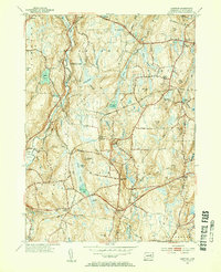
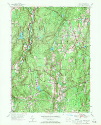
1953 Map of Hampton
USGS Topo · Published 1955About this map
Nathaniel Lyon Memorial Park and the sprawling Natchaug State Forest dominate this landscape in eastern Connecticut, where the winding Natchaug River and Little River cut through a terrain marked by numerous family-named hills and glacial basins. The map illustrates the region's mid-century rural character, anchored by the village of Hampton and smaller settlements like Slovik and Elliotts. Infrastructure of the era is clearly visible, including the New York New Haven and Hartford rail line passing through the Hampton Sta. This survey, revised in the early 1950s from 1943 data, captures a quiet moment before modern suburbanization, preserving the location of local landmarks like the Elliotts Sch and Litchfield Cem, alongside historical thoroughfares such as the Kings Highway and the Grand Army of the Republic Highway.
Find a feature on this map
73 named features on this map. Tap any name to fly to it.
Don’t see what you’re looking for? This feature index may not catch every label — zoom into the map to look around manually.
Map Details
Editions of this 1953 Hampton Map
5 editions found
Other maps of this area

1889 · Putnam
USGS Topo · 1:62,500

1889 · Moosup
USGS Topo · 1:62,500

1892 · Woodstock
USGS Topo · 1:62,500

1892 · Norwich
USGS Topo · 1:62,500

1893 · Putnam
USGS Topo · 1:62,500

1893 · Moosup
USGS Topo · 1:62,500

1919 · Putnam
USGS Topo · 1:62,500

1920 · Moosup
USGS Topo · 1:62,500

1921 · Woodstock
USGS Topo · 1:62,500

1943 · Plainfield
USGS Topo · 1:31,680