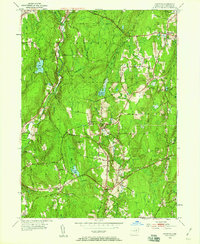
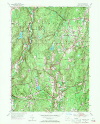
1953 Map of Hampton
USGS Topo · Published 1959About this map
The Natchaug State Forest dominates the wooded highlands of central Windham County, marking a landscape defined by significant mid-century forest management and water conservation. The Natchaug River flows through the western reaches, passing near the Nathaniel Lyon Memorial Park and the settlement of Phoenixville. To the east, the New York New Haven and Hartford railroad cuts through the terrain, serving Hampton and the Hampton Sta. This corridor illustrates the region's reliance on rail transport for connecting small rural hamlets like Rawson and Abington. Local landmarks such as the Litchfield Cem and Elliotts Sch provide valuable points of reference for genealogists. The map also captures numerous water features vital to the local ecology and history, including Pine Acres Lake, Hampton Reservoir, and the extensive Cedar Swamp.
Find a feature on this map
44 named features on this map. Tap any name to fly to it.
Don’t see what you’re looking for? This feature index may not catch every label — zoom into the map to look around manually.
Map Details
Editions of this 1953 Hampton Map
5 editions found
Other maps of this area

1889 · Putnam
USGS Topo · 1:62,500

1889 · Moosup
USGS Topo · 1:62,500

1892 · Woodstock
USGS Topo · 1:62,500

1892 · Norwich
USGS Topo · 1:62,500

1893 · Putnam
USGS Topo · 1:62,500

1893 · Moosup
USGS Topo · 1:62,500

1919 · Putnam
USGS Topo · 1:62,500

1920 · Moosup
USGS Topo · 1:62,500

1921 · Woodstock
USGS Topo · 1:62,500

1943 · Plainfield
USGS Topo · 1:31,680