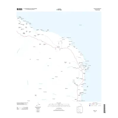
2013 Map of Hana
USGS Topo · Published 2013About this map
Pi'ilanihale Heiau stands as a significant cultural landmark on the northern coast of Maui, overlooking the Pacific Ocean near Kalāhū Point. This 2013 survey of the eastern coastline documents the infrastructure of Hāna, where Hāna Wharf and the Ka'uiki Light mark the entrance to Hāna Bay. The landscape is defined by a series of steep gulches including Waihole Gulch and Honomāele Gulch, which channel water from the inland heights of Olopawa and Pākī toward the shore.
Find a feature on this map
115 named features on this map. Tap any name to fly to it.
Don’t see what you’re looking for? This feature index may not catch every label — zoom into the map to look around manually.
Map Details
Editions of this 2013 Hana Map
This is the sole edition of this map. No revisions or reprints were ever made.
Other maps of this area

1954 · Maui
USGS Topo · 1:250,000

1957 · Kipahulu
USGS Topo · 1:24,000

1957 · Hana
USGS Topo · 1:24,000

1957 · Nahiku
USGS Topo · 1:24,000

1957 · Kaupo
USGS Topo · 1:24,000

1957 · Keanae
USGS Topo · 1:24,000

1966 · Maui
USGS Topo · 1:250,000

1974 · Maui
USGS Topo · 1:250,000

1978 · Hana
USGS Topo · 1:24,000

1983 · Nahiku
USGS Topo · 1:24,000