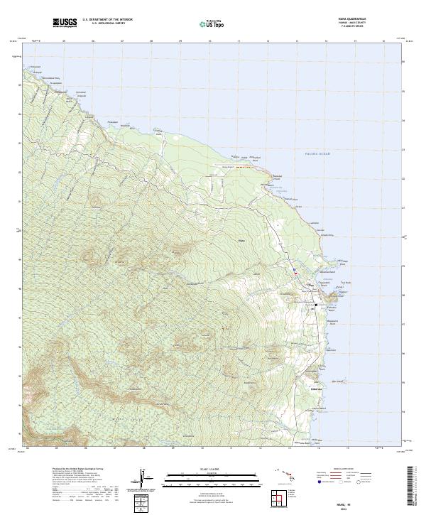
2024 Map of Hana
USGS Topo · Published 2024About this map
The town of Hana serves as the focal point of this coastal Maui survey, situated where the slopes of the Haleakala National Park meet the Pacific. The landscape is defined by a series of points and bays, from the prominent Ka‘uiki Head at the harbor to the dark sands of Waikoloa Beach. Local infrastructure is concentrated around the Hana District Courthouse and the nearby Hana Airport, while residential clusters extend toward Helani and Olopawa.
Find a feature on this map
105 named features on this map. Tap any name to fly to it.
Don’t see what you’re looking for? This feature index may not catch every label — zoom into the map to look around manually.
Map Details
Editions of this 2024 Hana Map
This is the sole edition of this map. No revisions or reprints were ever made.
Other maps of this area

1954 · Maui
USGS Topo · 1:250,000

1957 · Kipahulu
USGS Topo · 1:24,000

1957 · Hana
USGS Topo · 1:24,000

1957 · Nahiku
USGS Topo · 1:24,000

1957 · Kaupo
USGS Topo · 1:24,000

1957 · Keanae
USGS Topo · 1:24,000

1966 · Maui
USGS Topo · 1:250,000

1974 · Maui
USGS Topo · 1:250,000

1978 · Hana
USGS Topo · 1:24,000

1983 · Nahiku
USGS Topo · 1:24,000