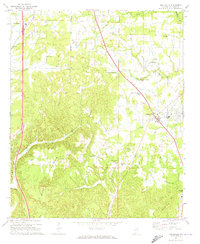
1969 Map of Hanceville
USGS Topo · Published 1969About this map
Hanceville serves as the focal point of this late-1960s survey, showing a landscape defined by the intersection of the Louisville and Nashville railroad and a modernizing highway network. The area’s rural character is anchored by a dense concentration of local institutions, including Shady Grove Ch, Edgewood Ch, and the George C Wallace State Trade Sch.
Find a feature on this map
40 named features on this map. Tap any name to fly to it.
Don’t see what you’re looking for? This feature index may not catch every label — zoom into the map to look around manually.
Map Details
Editions of this 1969 Hanceville Map
4 editions found
Other maps of this area

1888 · Cullman
USGS Topo · 1:125,000

1889 · Birmingham
USGS Topo · 1:125,000

1892 · Cullman
USGS Topo · 1:125,000

1892 · Birmingham
USGS Topo · 1:125,000

1895 · Birmingham
USGS Topo · 1:125,000

1907 · Birmingham
USGS Topo · 1:125,000

1951 · Arkadelphia
USGS Topo · 1:24,000

1951 · Blount Springs
USGS Topo · 1:24,000

1953 · Birmingham
USGS Topo · 1:250,000

1956 · Birmingham
USGS Topo · 1:250,000