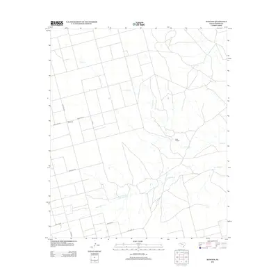
2012 Map of Hancock
USGS Topo · Published 2012About this map
The settlement of Hancock serves as a central point in this Dawson County landscape, situated at the junction of Ranch Road 2411 and Ranch Road 178. The terrain is defined by a series of intermittent watercourses, most notably the seasonal drainages of Tobacco Cr and Wet Tobacco Cr. These waterways cut through the arid High Plains, eventually converging near the geological formation known as Rock Canyon in the eastern portion of the quadrangle.
Find a feature on this map
11 named features on this map. Tap any name to fly to it.
Don’t see what you’re looking for? This feature index may not catch every label — zoom into the map to look around manually.
Map Details
Editions of this 2012 Hancock Map
This is the sole edition of this map. No revisions or reprints were ever made.
Other maps of this area

1954 · Big Spring
USGS Topo · 1:250,000

1958 · Big Spring
USGS Topo · 1:250,000

1968 · Lamesa North
USGS Topo · 1:24,000

1968 · Hancock
USGS Topo · 1:24,000

1969 · Gooch Lake
USGS Topo · 1:24,000

1969 · O'Donnell
USGS Topo · 1:24,000

1969 · Indian Canyon
USGS Topo · 1:24,000
1970 · Indian Canyon NW
USGS Topo · 1:24,000

1970 · Lamesa South
USGS Topo · 1:24,000

1970 · Key
USGS Topo · 1:24,000