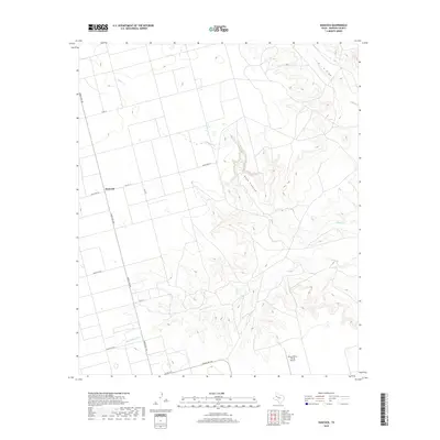
2019 Map of Hancock
USGS Topo · Published 2019About this map
Hancock sits at the intersection of Ranch Rd 2411 and Ranch Rd 178 in this part of Dawson County, characterized by a transition from flat agricultural blocks to the deep, winding incisions of the Llano Estacado. The eastern half of the map is dominated by the dramatic topography of Rock Canyon and the branching drainages of Tobacco Cr and Wet Tobacco Cr. This drainage system creates a sharp contrast between the geometric grid of county roads like Co Rd 12 and the natural erosion patterns leading toward T J F Draw. Aviation history is noted by the presence of Benny White Flying Airport in the south, while the network of ranch-to-market roads and secondary routes like Co Rd 14 and Ranch Rd 826 illustrates the modern transport infrastructure supporting this West Texas landscape.
Find a feature on this map
15 named features on this map. Tap any name to fly to it.
Don’t see what you’re looking for? This feature index may not catch every label — zoom into the map to look around manually.
Map Details
Editions of this 2019 Hancock Map
This is the sole edition of this map. No revisions or reprints were ever made.
Other maps of this area

1954 · Big Spring
USGS Topo · 1:250,000

1958 · Big Spring
USGS Topo · 1:250,000

1968 · Lamesa North
USGS Topo · 1:24,000

1968 · Hancock
USGS Topo · 1:24,000

1969 · Gooch Lake
USGS Topo · 1:24,000

1969 · O'Donnell
USGS Topo · 1:24,000

1969 · Indian Canyon
USGS Topo · 1:24,000

1970 · Indian Canyon NW
USGS Topo · 1:24,000

1970 · Lamesa South
USGS Topo · 1:24,000

1970 · Key
USGS Topo · 1:24,000