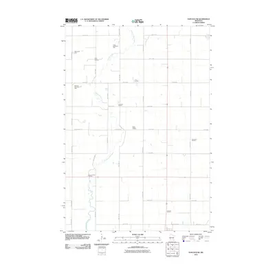
2010 Map of Hancock SW
USGS Topo · Published 2010About this map
The Pomme de Terre River meanders through this portion of Swift County, anchoring a landscape defined by its rural cemeteries and small-scale water management. Genealogists will find several burial grounds distributed across the grid of section roads, including Saint Johns Cemetery, Trinity Cemetery, and the Smith- Kepner Cemetery. The presence of multiple dams, such as the Marquardt Dam, Frank Schlieman Dam, and Berthold Koosmann Dam, reflects the local engineering efforts to manage the river's flow for the surrounding agricultural community. These named features, alongside the Evangelical Cemetery and Immanuel Cemetery, provide a detailed record of family and community heritage in the early 21st century, centered around the intersection of local transport routes like County Hwy-58 and the river valley.
Find a feature on this map
21 named features on this map. Tap any name to fly to it.
Don’t see what you’re looking for? This feature index may not catch every label — zoom into the map to look around manually.
Map Details
Editions of this 2010 Hancock SW Map
This is the sole edition of this map. No revisions or reprints were ever made.
Other maps of this area

1953 · Milbank
USGS Topo · 1:250,000

1953 · Saint Cloud
USGS Topo · 1:250,000

1957 · Saint Cloud
USGS Topo · 1:250,000

1958 · Milbank
USGS Topo · 1:250,000

1958 · Saint Cloud
USGS Topo · 1:250,000

1958 · Big Bend City
USGS Topo · 1:24,000

1958 · Milan NW
USGS Topo · 1:24,000

1958 · Appleton
USGS Topo · 1:24,000

1968 · Dry Wood Lake
USGS Topo · 1:24,000

1968 · Lake Oliver
USGS Topo · 1:24,000