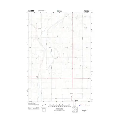
2013 Map of Hancock SW
USGS Topo · Published 2013About this map
The Pomme de Terre River meanders southward through this rural section of Swift County, anchoring a landscape defined by agricultural homesteads and quiet country crossroads. In the southern reach of the survey, the village of Holloway sits along Us-12, serving as the primary settlement for this prairie region. The area is notable for its high density of historical burying grounds, providing a significant record for genealogical research. Scattered across the township are Saint Johns Cem, Trinity Cem, Evangelical Cem, Smith-Kepner Cem, and several others, reflecting the early church-centered communities that established themselves near landmarks like Koosmann Farms. This 2013 topographic study documents the persistent rural character of western Minnesota, where the drainage of the river and the precise grid of section roads like 50th St NW continue to dictate the local geography.
Find a feature on this map
19 named features on this map. Tap any name to fly to it.
Don’t see what you’re looking for? This feature index may not catch every label — zoom into the map to look around manually.
Map Details
Editions of this 2013 Hancock SW Map
This is the sole edition of this map. No revisions or reprints were ever made.
Other maps of this area

1953 · Milbank
USGS Topo · 1:250,000

1953 · Saint Cloud
USGS Topo · 1:250,000

1957 · Saint Cloud
USGS Topo · 1:250,000

1958 · Milbank
USGS Topo · 1:250,000

1958 · Saint Cloud
USGS Topo · 1:250,000

1958 · Big Bend City
USGS Topo · 1:24,000

1958 · Milan NW
USGS Topo · 1:24,000

1958 · Appleton
USGS Topo · 1:24,000

1968 · Dry Wood Lake
USGS Topo · 1:24,000

1968 · Lake Oliver
USGS Topo · 1:24,000