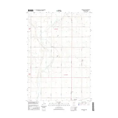
2016 Map of Hancock SW
USGS Topo · Published 2016About this map
The Pomme de Terre River winds through the agricultural landscape of western Minnesota in this 2016 survey, defining the terrain as it meanders southward toward Holloway. The map reveals a deeply rooted rural community, marked by a high density of small family and community burial grounds scattered across the townships. Genealogists and local historians can trace the heritage of the area through sites such as Trinity Cem, Smith-Kepner Cem, and multiple locations dedicated to Saint John's Cem. The settlement at Holloway anchors the southern portion of the sheet, while a rigid grid of country roads, including Co RD 56 and Co RD 59, sections the land into productive fields. This late 20th-century landscape maintains the traditional Midwestern settlement pattern, where small churches and cemeteries like Evangelical Cem and Immanuel Cem serve as the primary landmarks between isolated farmsteads.
Find a feature on this map
32 named features on this map. Tap any name to fly to it.
Don’t see what you’re looking for? This feature index may not catch every label — zoom into the map to look around manually.
Map Details
Editions of this 2016 Hancock SW Map
This is the sole edition of this map. No revisions or reprints were ever made.
Other maps of this area

1953 · Milbank
USGS Topo · 1:250,000

1953 · Saint Cloud
USGS Topo · 1:250,000

1957 · Saint Cloud
USGS Topo · 1:250,000

1958 · Milbank
USGS Topo · 1:250,000

1958 · Saint Cloud
USGS Topo · 1:250,000

1958 · Big Bend City
USGS Topo · 1:24,000

1958 · Milan NW
USGS Topo · 1:24,000

1958 · Appleton
USGS Topo · 1:24,000

1968 · Dry Wood Lake
USGS Topo · 1:24,000

1968 · Lake Oliver
USGS Topo · 1:24,000