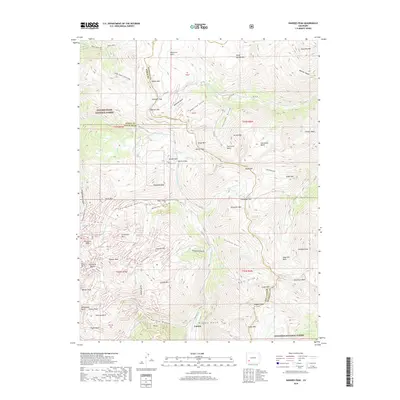
2019 Map of Handies Peak
USGS Topo · Published 2019About this map
Eureka sits at the confluence of the Animas River and Eureka Gulch, serving as a central point in this high-altitude landscape where Hinsdale Co, Ouray Co, and San Juan Co converge. The topography is defined by extreme elevations and deep drainage systems like Grouse Gulch and California Gulch. This 2019 survey captures the complex network of mountain infrastructure, including the Bagley Tunnel and high-mountain crossings like Cinnamon Pass and Engineer Pass. Historical industrial activity is etched into the terrain through named features like Denver Bridge and the various basins—American Basin, Hurricane Basin, and Horseshoe Basin—that once supported prospecting and transport. The map provides clear detail of the Gunnison National Forest and Uncompahgre National Forest boundaries, illustrating how early trails like the Bear Creek NRT follow natural watercourses like Bear Creek through the steep southern San Juan Mountains.
Find a feature on this map
94 named features on this map. Tap any name to fly to it.
Don’t see what you’re looking for? This feature index may not catch every label — zoom into the map to look around manually.
Map Details
Editions of this 2019 Handies Peak Map
This is the sole edition of this map. No revisions or reprints were ever made.
Other maps of this area

1897 · Silverton
USGS Topo · 1:62,500

1901 · Silverton
USGS Topo · 1:62,500

1902 · Silverton
USGS Topo · 1:62,500

1902 · Ouray
USGS Topo · 1:62,500

1903 · Lake City
USGS Topo · 1:62,500

1904 · Ouray
USGS Topo · 1:62,500

1905 · Lake City
USGS Topo · 1:62,500

1905 · San Cristobal
USGS Topo · 1:125,000

1907 · San Cristobal
USGS Topo · 1:125,000

1908 · Uncompahgre
USGS Topo · 1:125,000