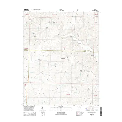
2015 Map of Handy
USGS Topo · Published 2015About this map
The settlement of Handy sits at the intersection of several county roads in this portion of the Ozark Plateau, where the borders of Oregon, Carter, and Ripley counties meet. Much of the landscape is protected within the Mark Twain National Forest, characterized by an intricate network of hollows that speak to the area's pioneer history and local nomenclature, such as Stillhouse Hollow, Church House Hollow, and Buffalo Wallow. Water is a defining element of this terrain, with drainage moving through Big Barren Creek and Running Water Creek. The map documents several upland sinks and water sources, including Cupola Pond, McFarland Pond, and Spout Spring. For those tracing family history in the region, Bristol Cemetery provides a specific point of reference north of the main settlement. The abundance of named hollows like Bearpen and Deer Pond suggests a landscape long shaped by hunting and small-scale timber extraction.
Find a feature on this map
61 named features on this map. Tap any name to fly to it.
Don’t see what you’re looking for? This feature index may not catch every label — zoom into the map to look around manually.
Map Details
Editions of this 2015 Handy Map
This is the sole edition of this map. No revisions or reprints were ever made.
Other maps of this area

1939 · Doniphan
USGS Topo · 1:62,500

1941 · Gatewood
USGS Topo · 1:62,500

1944 · Van Buren
USGS Topo · 1:62,500

1944 · Grandin
USGS Topo · 1:62,500

1945 · Doniphan
USGS Topo · 1:62,500

1945 · Gatewood
USGS Topo · 1:62,500

1946 · Grandin
USGS Topo · 1:62,500

1946 · Van Buren
USGS Topo · 1:62,500

1957 · Poplar Bluff
USGS Topo · 1:250,000

1959 · Poplar Bluff
USGS Topo · 1:250,000