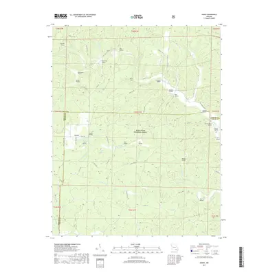
2017 Map of Handy
USGS Topo · Published 2017About this map
Handy serves as a central point of reference in this densely wooded portion of the Mark Twain National Forest. The landscape is defined by an intricate network of drainage systems, including the Little Barren Cr, Running Water Cr, and Cave Fork, which have carved out numerous named hollows throughout the terrain. Significant water features such as Cupola Pond, McFarland Pond, and West Pond provide localized hydrological interest alongside named springs like Spout Spring and Hodo Spring. Genealogists and local historians can locate the Bristol Cem in the northern portion of the map, while several family-named landmarks such as Stillhouse Hollow, Johnson Hollow, and Davis Hollow suggest the historical settlement patterns of this Missouri Ozark region. The presence of features like Buffalo Wallow and Tram Hollow hints at the environmental and industrial history of the area, all connected by a web of Forest Service roads and state highways.
Find a feature on this map
65 named features on this map. Tap any name to fly to it.
Don’t see what you’re looking for? This feature index may not catch every label — zoom into the map to look around manually.
Map Details
Editions of this 2017 Handy Map
This is the sole edition of this map. No revisions or reprints were ever made.
Other maps of this area

1939 · Doniphan
USGS Topo · 1:62,500

1941 · Gatewood
USGS Topo · 1:62,500

1944 · Van Buren
USGS Topo · 1:62,500

1944 · Grandin
USGS Topo · 1:62,500

1945 · Doniphan
USGS Topo · 1:62,500

1945 · Gatewood
USGS Topo · 1:62,500

1946 · Grandin
USGS Topo · 1:62,500

1946 · Van Buren
USGS Topo · 1:62,500

1957 · Poplar Bluff
USGS Topo · 1:250,000

1959 · Poplar Bluff
USGS Topo · 1:250,000