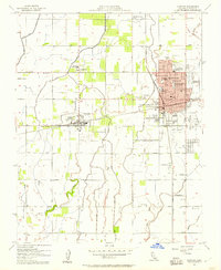
1954 Map of Hanford
USGS Topo · Published 1957About this map
Hanford serves as the dense municipal core of this San Joaquin Valley survey, showing a highly developed grid of civic institutions during the mid-1950s. The town's expansion is evident through its numerous educational sites, including Hanford Union High School and Thomas McCarthy Memorial Sch, alongside the Kings County General Hosp. The surrounding agricultural landscape is defined by the complex water management of Mussel Slough and the New Deal Canal, which feed the various orchards and fields throughout Kings County. To the west, the smaller settlements of Armona and Grangeville maintain their distinct identities, connected to the county seat by the Southern Pacific and Atchison Topeka and Santa Fe railroads. Notable rural landmarks like the Drive-in Theatre and the County Fairgrounds provide a glimpse into the social and commercial life of this post-war farming community.
Find a feature on this map
51 named features on this map. Tap any name to fly to it.
Don’t see what you’re looking for? This feature index may not catch every label — zoom into the map to look around manually.
Map Details
Editions of this 1954 Hanford Map
2 editions found
Other maps of this area

1924 · Riverdale
USGS Topo · 1:31,680

1926 · Hanford
USGS Topo · 1:31,680

1926 · Burris Park
USGS Topo · 1:31,680

1927 · Laton
USGS Topo · 1:31,680

1927 · Remnoy
USGS Topo · 1:31,680

1927 · Riverdale
USGS Topo · 1:31,680

1927 · Lemoore
USGS Topo · 1:31,680

1928 · Waukena
USGS Topo · 1:31,680

1929 · Guernsey
USGS Topo · 1:31,680

1929 · Stratford
USGS Topo · 1:31,680